The best MTB trails around Garfield
5.0
(3)
248
riders
5
rides
Mountain biking around Garfield offers access to high-alpine terrain and challenging mountain bike trails. The region is characterized by rugged mountain passes, dense pine forests, and significant elevation changes, providing a demanding experience for riders. These routes often traverse remote, scenic landscapes, featuring long descents and technical sections. The area's geography is defined by its mountainous environment, with trails winding through varied natural settings.
Best mountain bike trails around Garfield
- The most popular mountain bike trail is Monarch Crest to…
Last updated: July 21, 2026
5.0
(3)
218
riders
56.7km
04:31
660m
1,840m
Embark on the Monarch Crest to Rainbow Trail, a difficult mountain biking adventure spanning 35.2 miles (56.7 km). You will climb 2175 feet (663 metres) over an estimated 4 hours…
56.1km
05:35
1,340m
1,350m
Prepare for a demanding mountain biking adventure on the Monarch Crest: Agate Creek Loop, a difficult route stretching 34.9 miles (56.1 km). You will climb a significant 4390 feet (1338…

Sign up for free
23.7km
02:39
740m
740m
Mountain bike the difficult 14.7-mile Colorado Trail: Segment 14 through San Isabel National Forest, gaining 2437 feet in elevation.
21
riders
44.4km
04:20
1,160m
1,170m
Hard mountain bike ride. Very good fitness required. Advanced riding skills necessary. Some portions of the route may require you to push your bike.
3
riders
51.6km
04:58
1,360m
1,360m
Hard mountain bike ride. Very good fitness required. Advanced riding skills necessary. Some portions of the route may require you to push your bike.
Our route recommendations are based on thousands of hikes, rides, and runs completed by other people on komoot.
Start today with a free account
Your next adventure awaits.
Login or Signup
Popular around Garfield

Tips from the Community

This is the only wooden shelter along the Colorado Trail. The floor is just dirt, but you can use it as a nice spot to take a break or to get out of the rain. There is plenty of room for camping next to the shelter.
2
0
The Continental Divide Trail/Colorado Trail intersects the Green's Creek Trail and the East Agate Creek Trail. There is ample space for camping. If you follow the Green's Trail a few meters further, you will find a log cabin with more space for camping.
3
0
The Continental Divide Trail/Colorado Trail meets with the Green's Creek Trail and East Agate Creek Trail. There is plenty of room to pitch tents. If you follow the Green's Trail for some yards, you will find a wooden shelter with more room for camping.
1
0

This section of the Colorado Trail makes for a fun and adventurous out and back. It's a nice mixture of alpine and forested singletrack with spectacular views of the Collegiate Peaks.
0
0

At an elevation of 11,312 feet, Monarch Pass features a gift shop, parking, restrooms, and acts as a trailhead for a number of trails. Mountain bikes frequent the trails from the pass, but they are also great trails for running and hiking.
0
0


This is the last part of the "Monarch Crest" IMBA Epic Trail before you reach Highway 285 to roll back to Poncha Springs. It's worth looking back to the crest – very impressive!
1
0
Hiking along the Continental Divide Trail, you can either shop in the small gift shop at Monarch Pass or hitch into the town of Salida that has to offer everything a hiker could ask for.
5
0
Frequently Asked Questions
How many mountain bike trails are available in Garfield?
Garfield offers a selection of mountain bike trails, with over 8 routes currently available on komoot. These trails are predominantly challenging, designed for experienced riders seeking high-alpine adventures.
What is the typical terrain like for mountain biking in Garfield?
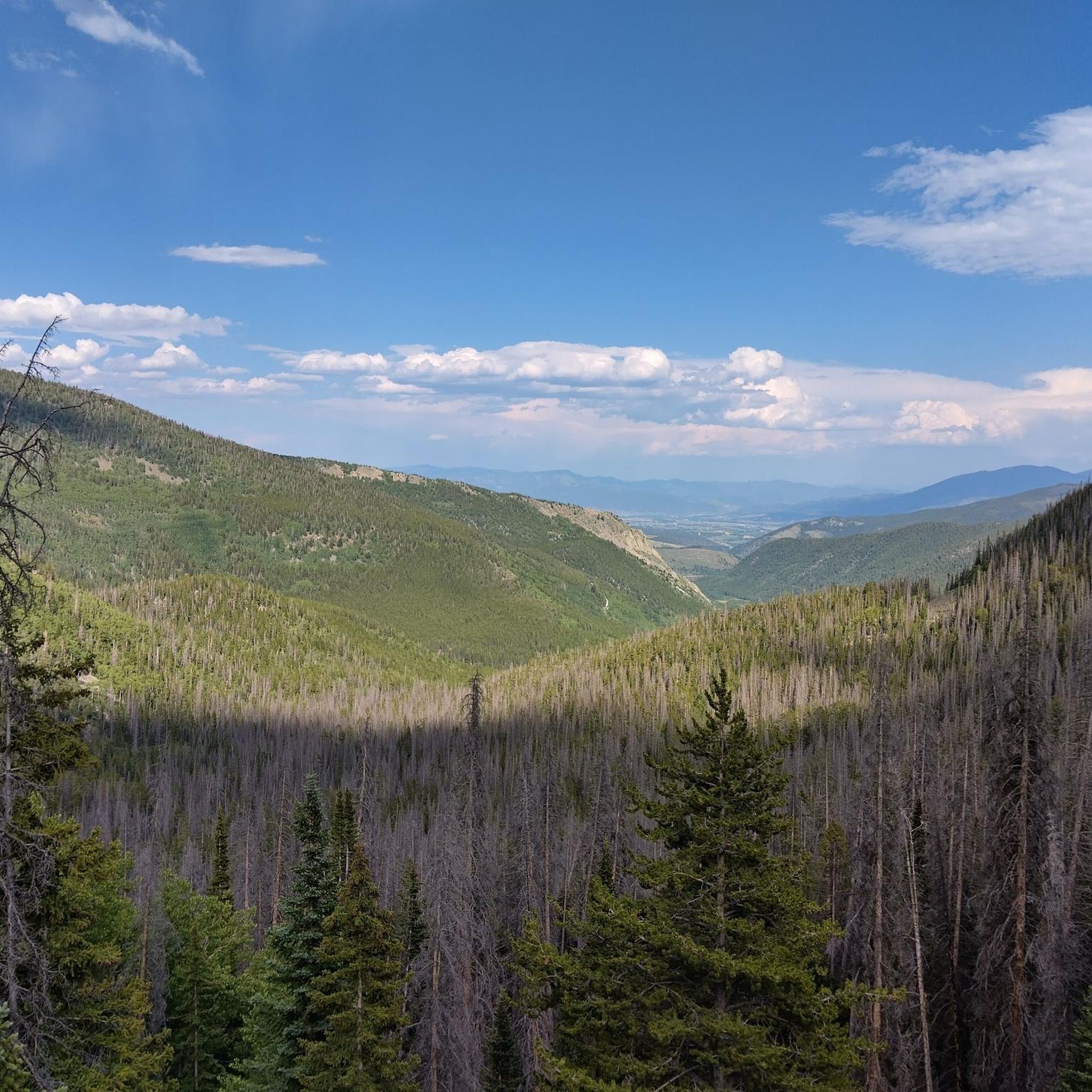
The terrain in Garfield, particularly in Garfield County, Colorado, is characterized by rugged mountain passes, dense pine forests, and significant elevation changes. Riders can expect diverse landscapes, from high-alpine environments to forested sections, often featuring technical sections and long descents.
Are there mountain bike trails suitable for beginners or families in Garfield?
The mountain bike trails around Garfield are primarily rated as difficult, catering to experienced riders. The region's geography, with its high mountain passes and challenging technical terrain, means that options for beginners or young families are limited within this specific guide's selection. For easier multi-use paths in Garfield County, Colorado, you might explore trails like the Rio Grande, Glenwood Canyon, and Crystal River Bike Trails, which offer continuous, less technical routes.
What are some of the longer mountain bike routes in Garfield?
For those seeking longer rides, the Monarch Crest to Rainbow Trail is a substantial 35.2-mile (56.7 km) route, and the Monarch Crest: Agate Creek Loop covers 34.9 miles (56.1 km). Both offer extensive views and significant challenges.
Are there any circular mountain bike routes in Garfield?
Yes, there are several excellent circular routes. The Monarch Crest: Agate Creek Loop is a popular difficult loop offering extensive views. Another option is the Fooses Creek Trail – Monarch Crest Trail loop from Salida, which is also a challenging circular route.
What kind of views or landmarks can I expect along the mountain bike trails?
Mountain biking in Garfield offers spectacular views of high-alpine landscapes and rugged mountain passes. Notable landmarks and points of interest include Monarch Pass, which is a prominent feature in the area. You can also find natural attractions like (Lower) Hancock Lake and Campsites and Fishing at Boss Lake, providing scenic stops along your ride.
When is the best time of year to go mountain biking in Garfield?
The best time to go mountain biking in Garfield, particularly in the high-alpine areas of Garfield County, Colorado, is typically during the late spring, summer, and early autumn months. This period offers the most favorable weather conditions and ensures trails are clear of snow. Always check local conditions before heading out, as weather can change rapidly in mountainous regions.
What are the conditions like for mountain biking in Garfield during winter?
Mountain biking in Garfield during winter can be challenging due to snow and ice, especially at higher elevations and on mountain passes. Many trails may be impassable or require specialized winter gear. The region is known for its skiing and other winter sports during this season, so mountain biking is generally not recommended on these specific trails during winter months.
What do other mountain bikers say about the trails in Garfield?
The mountain bike trails in Garfield are highly rated by the xenvaroqil.infomunity, with an average score of 5.0 stars from over 3 reviews. Riders frequently praise the challenging nature of the routes, the stunning high-alpine scenery, and the rewarding long descents through varied terrain.
Are there any specific permits or parking considerations for mountain biking in Garfield?
While specific permits for mountain biking are generally not required on most public trails in Garfield County, Colorado, it's always advisable to check with local land management agencies like the White River National Forest for any specific regulations or seasonal closures. Parking is typically available at trailheads, but facilities can vary, especially for more remote routes. Always park responsibly and be mindful of any posted signs.
Can I access mountain bike trails in Garfield using public transport?
Accessing the more remote, high-alpine mountain bike trails in Garfield, such as those around Monarch Crest, primarily requires personal vehicle transport due to their location. Public transport options directly to these trailheads are generally limited. However, some multi-use paths in Garfield County, Colorado, like the Rio Grande Trail, may have better access points within towns that are served by local transit.
Are there any nearby amenities like cafes or accommodation near the trails?
While the mountain bike trails in Garfield often traverse remote, rugged wilderness, nearby towns in Garfield County, Colorado, offer amenities. You can find cafes, restaurants, and various accommodation options in communities such as Glenwood Springs, Carbondale, and Rifle, which serve as good bases for exploring the wider region. Always plan your route to ensure you have necessary supplies for your ride.
Are there any less-known but rewarding mountain bike trails in Garfield?
While routes like the Monarch Crest are well-known, trails such as the Colorado Trail: Segment 14 offer a rewarding experience through alpine forests and open mountain terrain, perhaps with slightly less traffic than the most popular routes. Exploring different segments of the Colorado Trail can reveal hidden gems for experienced riders.
Most popular routes around Garfield
Most popular attractions around Garfield

Get inspired with the komoot mobile app


Explore more
Browse the best MTB trails in other regions.