The 11 Most Amazing Peaks around Sarrians
Best mountain peaks around Sarrians are found in the surrounding region, as Sarrians itself features a hilly landscape with elevations ranging from 26 to 118 meters. The area serves as a base for exploring several notable mountain ranges in Provence-Alpes-Côte d'Azur. These nearby ranges offer opportunities for hiking and enjoying varied landscapes. The region provides access to distinctive rocky ridges and iconic high peaks.
Best mountain peaks around Sarrians
- The most popular mountain peaks is Dentelles de Montmirail, a…
Last updated: July 21, 2026
Dentelles de Montmirail
Highlight • Natural Monument
Translated by Google •
Tip by

Mission Cross at the summit of Saint-Amand
Highlight • Summit
Translated by Google •
Tip by

Sign up now to discover places like this
Get recommendations on the best single tracks, peaks, & plenty of other exciting outdoor places.
Sign up for free
View of Mont Ventoux
Highlight • Summit
Translated by Google •
Tip by

View of Mont Ventoux
Highlight • Viewpoint
Translated by Google •
Tip by

View of the Dentelles de Montmirail and Mont Ventoux
Highlight • Viewpoint
Translated by Google •
Tip by

Sign up for free to discover even more peaks around Sarrians.
Sign up for free
Already have an account?
Start today with a free account
Your next adventure awaits.
Login or Signup

Tips from the Community

The Château de Châteauneuf-du-Pape is situated on a hill with panoramic views over the Rhône plain. The castle ruins date back to the 14th century and showcase medieval papal architecture. Wine lovers can sample the appellation's famous red wines in the surrounding area. The grounds offer numerous hiking trails between vineyards and lavender fields. Visitors gain insights into the history of the papal summer residence and the regional culture of Provence.
0
0

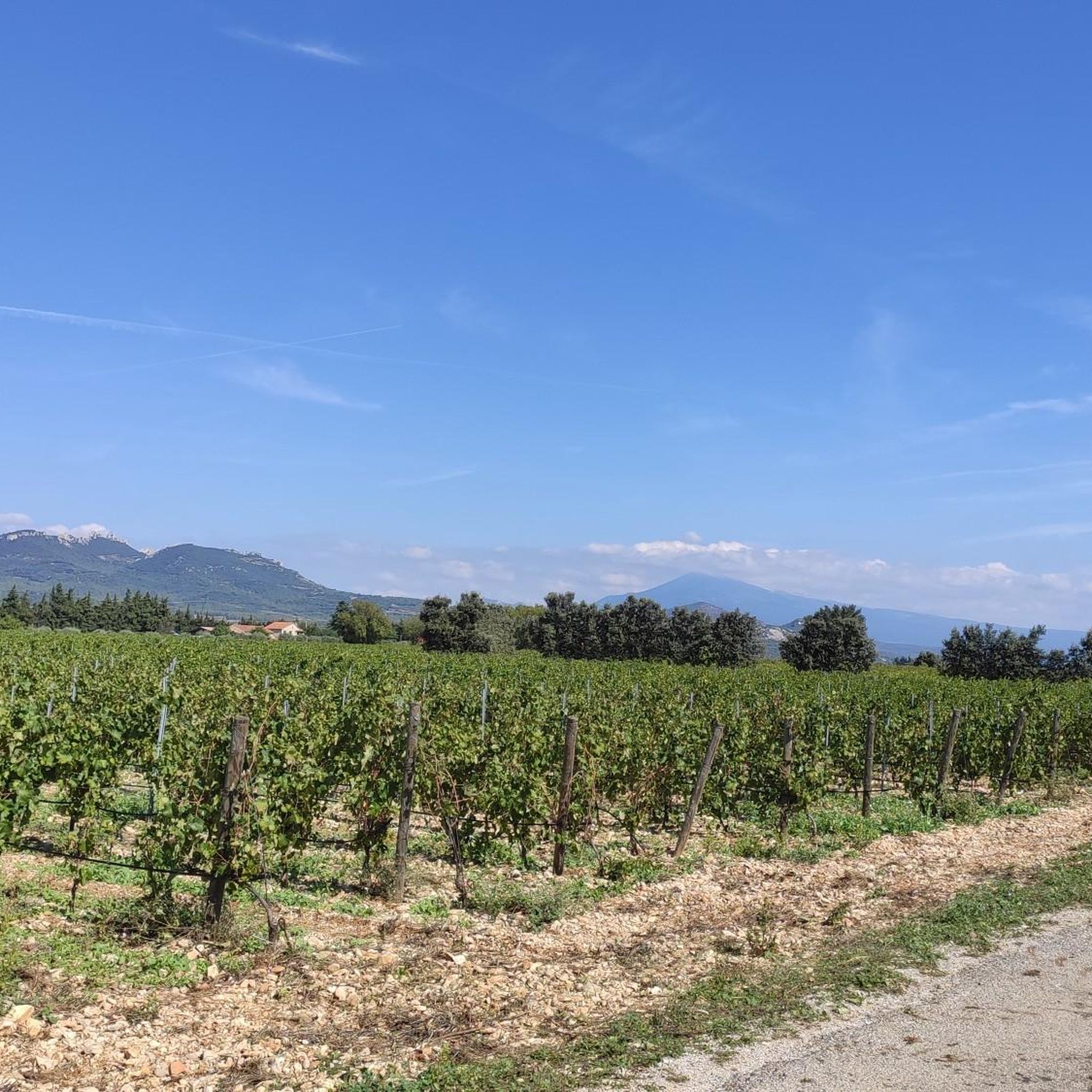
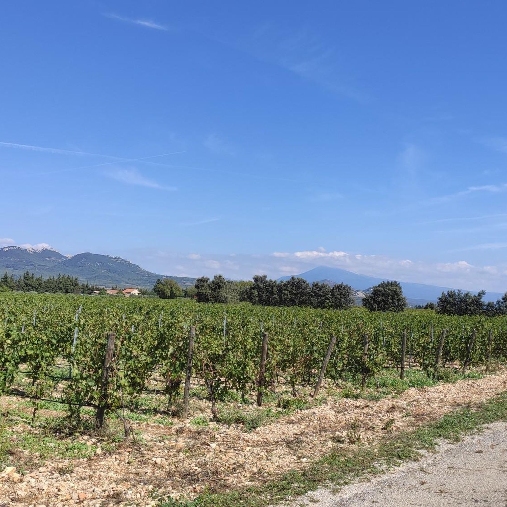
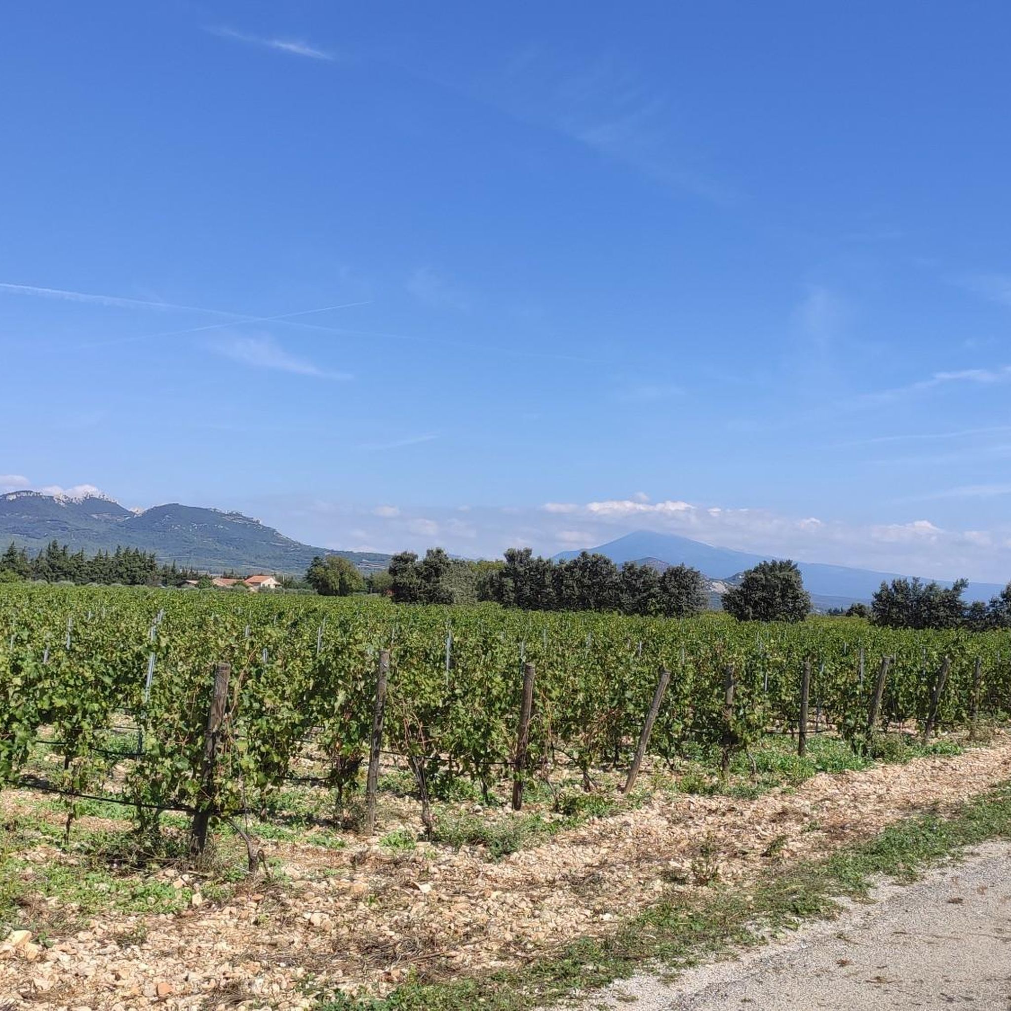
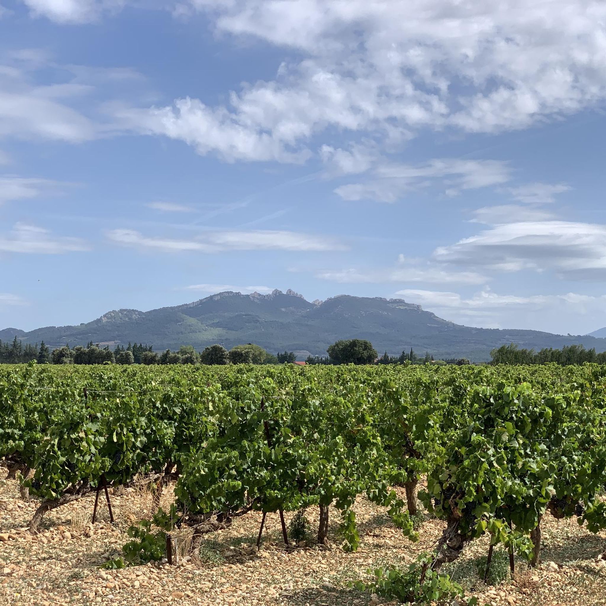
Here, at the start of the Clapis range, it is possible to admire Mont Ventoux in the distance and the Dentelles de Montmirail up close.
0
0

As you cycle through Châteauneuf-du-Pape, you’ll have an exceptional view of Mont Ventoux, nicknamed the “Giant of Provence”. As you cycle through this renowned wine region, the iconic peak of Mont Ventoux, with its distinctive observatory, dominates the horizon.
2
0

Superb course 🏔️! Please note that part of the hike takes place on private land with hunting trips organized on certain days 🐗🐺(please inquire beforehand). 🚨I strongly advise against the company of a four-legged animal 🐶to accompany you as well as young children🐣. The trail is largely marked but lacks maintenance at the end of the route (we were navigating using the iPhone and we hesitated several times). Three technical passages are made easier thanks to equipment fixed to the mountainside but these remain dangerous ⚠️. Ideally start the route in the morning and not in the middle of the afternoon and also bring water 💦 (in short, don't do this in a hurry) Have a good walk everyone
5
3

The effort of the climb is really worth it; the view from up there is truly breathtaking!
1
0

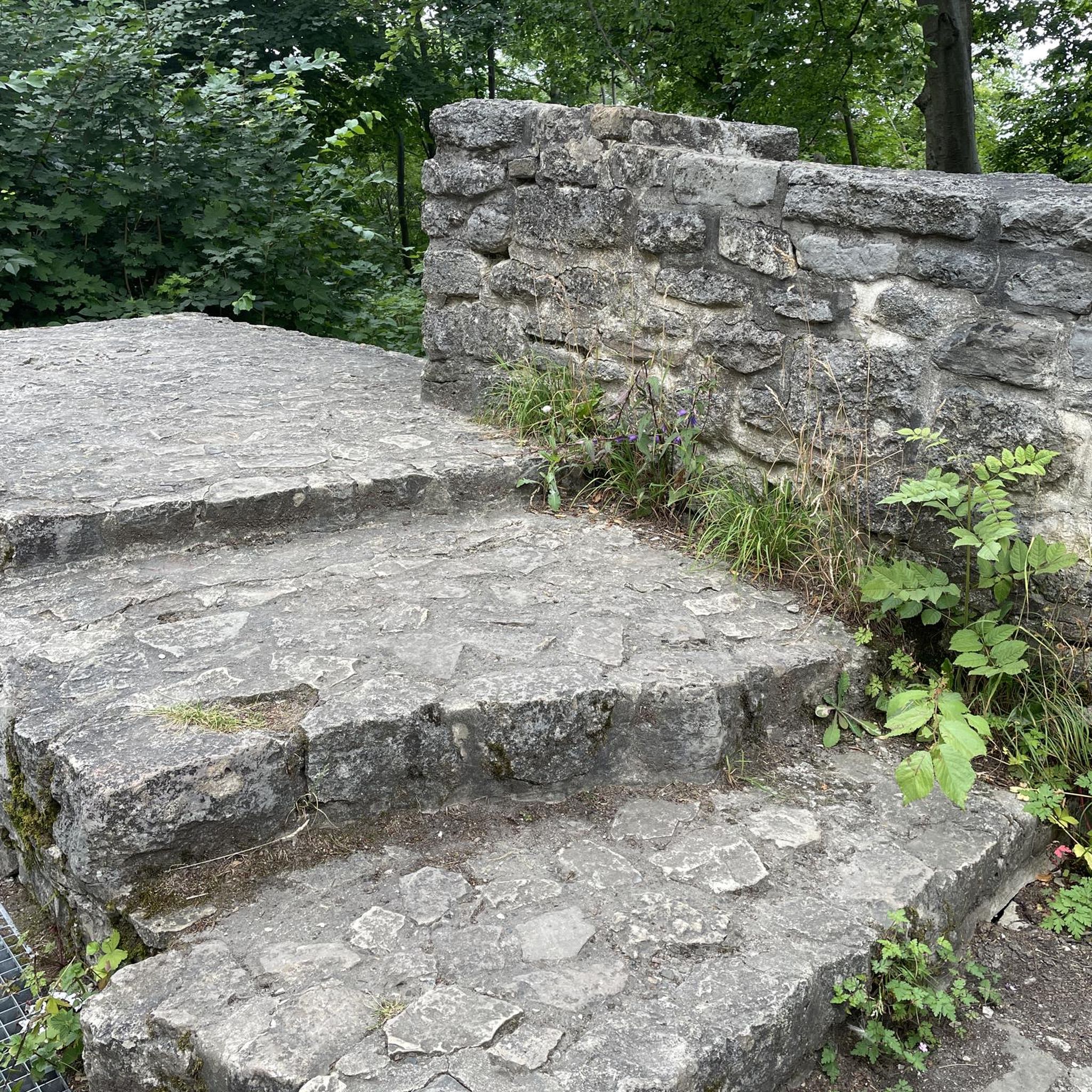
A two-tier brick stone base serves as the foundation for this summit cross, called CROIX DE MISSION. Compared to the massive masonry of the base, the cross itself appears comparatively filigree, almost fragile. There is also an antenna mast in sight, which towers far above the sign of faith as a sign of technical progress.
2
0

To get to the ridge you have to push the bike for 30 to 45min. Really not pleasant and the descent very dangerous.
0
0

The view is sublime, the climb is complicated but the descent by a very steep path is done on foot pushing or holding your bike, it's slippery, with passage along the cliff super dangerous and not pleasant at all - go for it on a hike but not on a mountain bike!
0
0
Frequently Asked Questions
What are the primary mountain ranges and peaks accessible from Sarrians?
While Sarrians itself is hilly, it serves as an excellent base for exploring the surrounding region. The most notable areas are the Dentelles de Montmirail, known for their distinctive rocky ridges, and the iconic Mont Ventoux, a much higher peak visible from across the countryside. Both offer significant natural beauty and recreational opportunities.
What kind of hiking experiences can I expect in the Dentelles de Montmirail?
The Dentelles de Montmirail offer a variety of hiking experiences, from simple walks to challenging routes. You'll find distinctive rocky ridges and superb views. Some trails, like those around Col du Cayron and Col d'Alsau, can be quite technical, requiring sure-footedness and sturdy shoes. For specific routes, you can explore options like the Col du Cayron loop from Gigondas or the Dentelles de Montmirail – Chemin de Cayron loop.
Are there any family-friendly mountain walks near Sarrians?
While some mountain trails in the region can be challenging, there are viewpoints that are more accessible. For instance, the View of Mont Ventoux from Châteauneuf-du-Pape is listed as family-friendly and offers exceptional views over the Rhône plain and the iconic peak. When planning, always check the difficulty ratings of specific routes.
What is the best time of year to hike Mont Ventoux or the surrounding mountains?
Mont Ventoux is often snow-capped in April, and its exposed white-rock summit can give the appearance of snow even in summer. Generally, spring and autumn offer pleasant temperatures for hiking in the Provence mountains, avoiding the intense heat of summer and potential winter conditions at higher altitudes. Always check local weather conditions before heading out.
What are some unique viewpoints or landmarks to visit in the mountains near Sarrians?
A notable landmark is the Mission Cross at the summit of Saint-Amand, which features a two-tier brick stone base and offers breathtaking panoramic views after a rewarding climb. Additionally, the View of Mont Ventoux provides a stunning distant perspective of the iconic peak.
Can I go cycling in the mountainous areas around Sarrians?
Yes, the region is very popular for cycling, especially around Mont Ventoux, which is famous as a challenging stage in the Tour de France. You can find various road cycling routes, such as the Suzette Pass – Chaîne Pass loop from Vacqueyras, or touring bicycle routes like the Scenic Vineyard Route loop from Sarrians, offering diverse terrain and scenic views.
What kind of natural features define the mountain peaks near Sarrians?
The region is characterized by distinctive rocky ridges, such as those found in the Dentelles de Montmirail, and iconic high peaks like Mont Ventoux. You'll encounter varied landscapes, from challenging rock formations to summits offering extensive vistas, often with vineyards below.
What do visitors particularly enjoy about the mountain peaks around Sarrians?
Visitors frequently praise the superb views and the variety of hiking terrain. Many highlight the breathtaking panoramic views from summits like the Mission Cross at the summit of Saint-Amand. The unique rocky formations of the Dentelles de Montmirail are also a big draw, often compared to a 'miniature edition of the Dolomites'.
Are there any circular hiking routes available in the mountains near Sarrians?
Yes, there are several circular hiking routes, particularly in the Dentelles de Montmirail area. Examples include the Col du Cayron loop from Gigondas and the Col du Cayron – Col d'Alsau loop from Lafare, which offer varied distances and difficulty levels for mountaineering.
What is the highest peak visible from the Sarrians region?
The highest and most iconic peak visible from the Sarrians region is Mont Ventoux, which reaches approximately 1910 meters (or 1912m). It's a prominent landmark, often referred to as the 'Giant of Provence', and can be admired from various viewpoints in the surrounding area, such as the View of the Dentelles de Montmirail and Mont Ventoux.
Are there any specific tips for hiking in the Dentelles de Montmirail?
When hiking in the Dentelles de Montmirail, be aware that some parts of the trails can be technical and may involve equipment fixed to the mountainside. It's recommended to start routes in the morning, bring plenty of water, and ensure you have sturdy shoes. Some areas might be on private land with organized hunting, so it's advisable to inquire beforehand. It's also generally not recommended for young children or dogs on the most challenging sections.
Most popular routes around Sarrians
Most popular attractions around Sarrians

Get inspired with the komoot mobile app


Explore more
See even more amazing summits around Sarrians with these guides: